| Country | Vietnam |
| Port/s | All Ports |
| Impact | Delays |
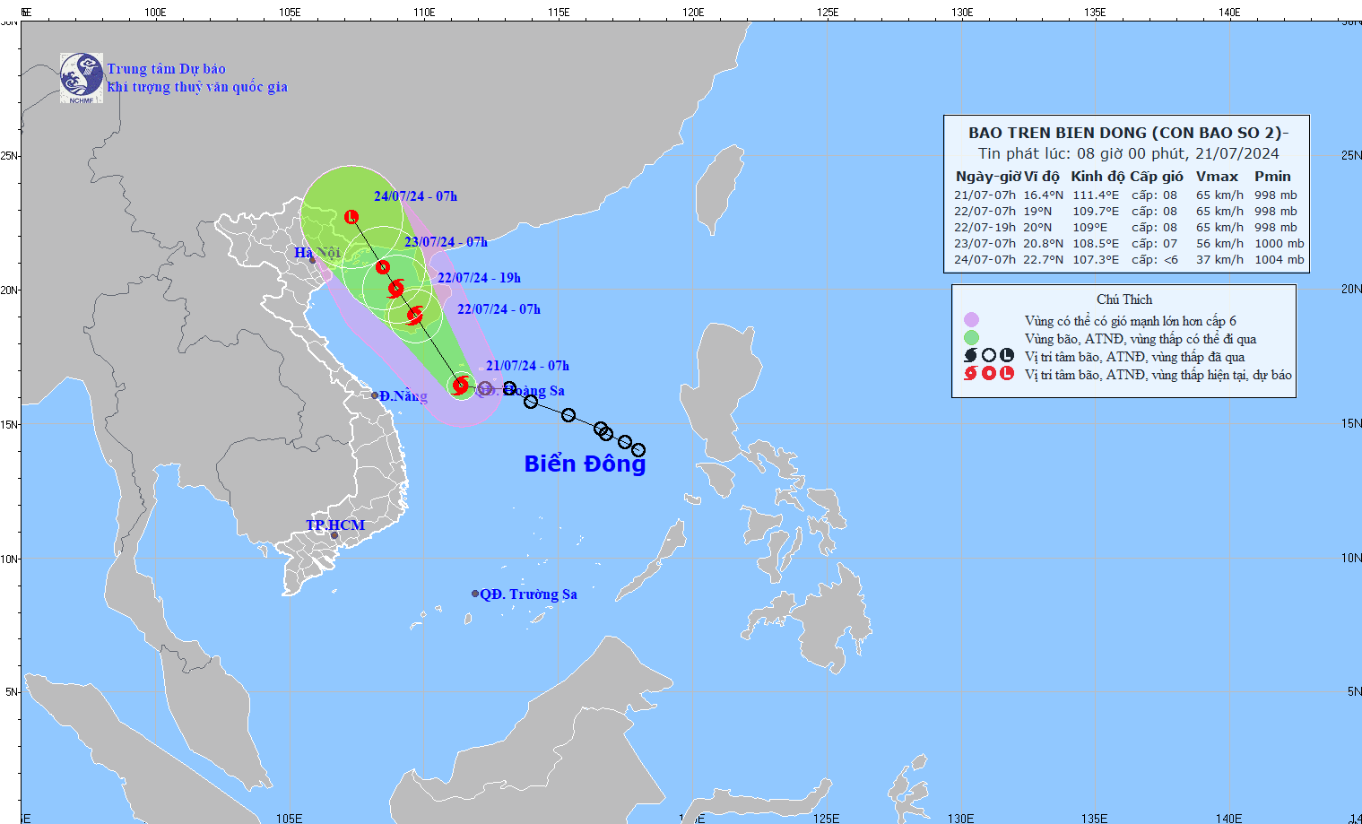
A tropical cyclone is expected to affect Cam Pha and Hai Phong ports in North Vietnam on July 23rd and 24th, 2024.
At 2100 UTC, the tropical depression over the central part of East Sea with central pressure 998 hectopascals was centred within 90 nautical miles of one six point four degrees north (16.4 N) one one one point five degrees east (111.5 E) and is forecast to move northwest at about 8 knots for the next 24 hours.
Maximum winds near the centre are estimated at 30 knots.
The radius of waves exceeding 2 meters is 90 nautical miles.

Forecast position and intensity at 220000 UTC
One nine point three degrees north (19.3 N)
One zero nine point seven degrees east (109.7 E)
Maximum winds 35 knots.
Forecast position and intensity at 230000 UTC
Two one point two degrees north (21.2 N)
One zero seven point nine degrees east (107.9 E)
Maximum winds 35 knots.
Forecast position and intensity at 240000 UTC
Dissipated over land.
In response to the official announcement for prevention of Tropical Storm No. 2 by the Port Authority and the weather forecast by the Vietnam Meteorological and Hydrological Administration, all vessels in Cam Pha and Hai Phong ports are required to:
- to keep close watching while at anchorage
- to keep engines ready for manoeuvring if required by Port Authority
- to ensure all onboard activities are conducted safely to prevent theft, accidents, or pollution
- to maintain close contact with onboard agents and Port Authority on VHF Channel 16 to avoid missing any important information